Humans have an inherent desire to find patterns. In a large-scale sense, scientists as renowned as Neil deGrasse Tyson believe that “humans’ pattern recognition skills determined natural selection.” The ability to recognize patterns is believed to stem from an area of the brain called the neocortex. Without diving too deep into the details, we seem to crave patterns to the point that we look for them where there is nothing. This is the reason we see faces in inanimate objects or believe that we can develop systems that will allow us to consistently win while gambling.
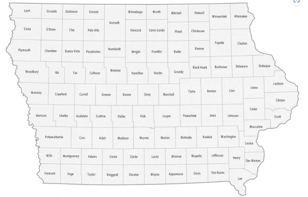
With that in mind, take a look at the county map of the state of Iowa.

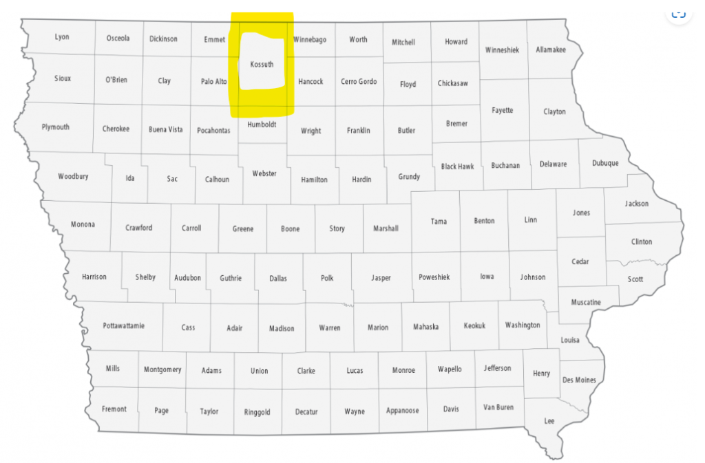
If nothing stands out to you, that’s fine. But upon closer examination, there is something that will melt your pattern-loving brain. It’s along the northern border, just west of center. See it?
What is this abomination?

That, my friends, is Kossuth County, Iowa. It is an affront to our neocortex. There’s a lovely continuity along the norther border of the state, and Kossuth County just pours a steaming pile of garbage all over it. Even worse, we love round numbers, and with Kossuth County being double-sized, Iowa ends up at… 99 counties. Surely there must be an explanation, right?
The answer, as usual, is complicated.
Iowa was accepted into the Union on December 28, 1846. News traveled slowly in those days and things took time to get done, so it wasn’t until the Iowa General Assembly took action in January of 1851 to establish counties and borders within the state. They created a handsome line of stacked counties along the northern border, which you can see in the image above, but you’ll have to imagine Kossuth County fitting the pattern by having a county to its north. At the time, it did, and Iowa had 100 counties.
Why Did Iowa Move to 99 Counties, Then?
Bancroft County made up the northern portion of modern-day Kossuth. The line was exact and the pattern was set, with the county named after George Bancroft. George served as Secretary of the Navy under President Polk, during which time he established the US Naval Academy. He then served as the United States Minister to the United Kingdom (and held a few other posts after the county was already named after him). However, six years after the county was established, through no fault of Bancroft’s, the county was dissolved and absorbed into Kossuth County to its south.
Why? Because Bancroft County was basically a swamp. It was predominantly marsh and wetlands, making it nearly unlivable. The situation was bad enough that they never established a county seat or any type of local government.
But the dream stayed alive.
Over a decade later, in 1870, the Iowa General Assembly once again created a county out of the northern portion of Kossuth County, this time called Crocker County (note: it’s unclear who Crocker was). There were about a dozen towns newly established in the area – perhaps the swamp waters receded – but the GA did not think this one through.
In 1871, the Iowa Supreme Court ruled the creation of the county to be unconstitutional on the grounds of it being fewer than 432 square miles, which is law in the state. How the county differed in size from the Bancroft iteration is unclear, as one may assume that the borders were the same as before, but apparently that’s wrong. The twelve established townships within the now-defunct county simply reverted to being part of Kossuth County.
BUT WAIT! In a truly inexplicable plot twist, existing counties apparently did not need to meet the 432 square mile threshold. The county which would be directly to the west of Crocker/Bancroft is called Emmet County. Emmet County is 403 square miles and is only the fourth smallest in the state of Iowa.
What a ride.
So while we love the idea of a consistent pattern and shape to the state of Iowa, it was not meant to be.
